Back شرق دونبارتونشاير Arabic Източен Дънбартъншър Bulgarian Siorrachd Dhùn Bhreatainn an Ear Breton East Dunbartonshire Catalan Малхбален Дамбартоншир CE East Dunbartonshire CEB East Dunbartonshire Czech Dwyrain Swydd Dunbarton Welsh East Dunbartonshire Danish East Dunbartonshire German
East Dunbartonshire
Aest Dunbartanshire Siorrachd Dhùn Bhreatann an Ear | |
|---|---|
 | |
| Coordinates: 55°56′N 4°13′W / 55.933°N 4.217°W | |
| Sovereign state | United Kingdom |
| Country | Scotland |
| Lieutenancy area | Dunbartonshire |
| Admin HQ | Kirkintilloch |
| Government | |
| • Body | East Dunbartonshire Council |
| • Control | Scottish National Party minority (council NOC) |
| • MPs |
|
| • MSPs |
|
| Area | |
| • Total | 67 sq mi (174 km2) |
| • Rank | Ranked 27th |
| Population (2022) | |
| • Total | 108,980 |
| • Rank | Ranked 21st |
| • Density | 1,600/sq mi (630/km2) |
| ONS code | S12000045 |
| ISO 3166 code | GB-EDU |
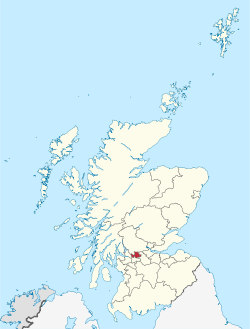
East Dunbartonshire (Scots: Aest Dunbartanshire; Scottish Gaelic: Siorrachd Dhùn Bhreatann an Ear, pronounced [ˈʃirˠəxk ɣum ˈpɾʲɛht̪ən̪ˠ əɲ ˈɛɾ]) is one of the 32 council areas of Scotland. It borders Glasgow City Council Area to the south, North Lanarkshire to the east, Stirling to the north, and West Dunbartonshire to the west. East Dunbartonshire contains many of the affluent areas north of Glasgow, including Bearsden, Milngavie, Milton of Campsie, Balmore, and Torrance, as well as many of Glasgow's commuter towns and villages. The council area covers parts of the historic counties of Dunbartonshire, Lanarkshire, and Stirlingshire.
The council area was formed in 1996, as a result of the Local Government etc. (Scotland) Act 1994, from the former Bearsden and Milngavie districts and most of the former Strathkelvin district, which had been part of the Strathclyde region.
© MMXXIII Rich X Search. We shall prevail. All rights reserved. Rich X Search
